| This article does not cite any references or sources. Please help improve this article by adding citations to reliable sources. Unsourced material may be challenged and removed. (February 2008) |
Template:Infobox River The Platte River is a river in the Western United States, approximately 310 mi (500 km) long. It is a tributary of the Missouri River, which in turn is a tributary of the Mississippi River. The Platte is one of the most significant river systems in the watershed of the Missouri, draining a large portion of the central Great Plains in Nebraska and the eastern Rocky Mountains in Colorado and Wyoming. The river played an important role in the westward expansion of the United States, providing the route for several major westward trails, including the Oregon Trail and the Mormon Trail. It was explored in the 18th century by French fur trappers, who also knew it as the Nebraska River.
Description[]

Platte River valley west of Omaha, Nebraska
The Platte River is formed in western Nebraska east of the city of North Platte by the confluence of its two affluents, the South Platte and the North Platte Rivers. Both of these arise from snowmelt in the eastern Rockies near the Continental Divide: the South Platte in Colorado, the North Platte in Wyoming. The Platte flows in a large arc, southeast then northeast, across Nebraska south of the Sandhills region, passing Gothenburg, Cozad, Kearney, and Grand Island. It is joined by the Loup River 5 miles (8 km) southeast of Columbus and flows east past North Bend and then Fremont. It then bends southward, passing south of Omaha, where it is joined by the Elkhorn River. It ends at its confluence with the Missouri 5 miles (8 km) north of Plattsmouth. Including the North Platte, the Platte stretches over 900 miles (1,400 km), with a drainage basin of 90,000 square miles (230,000 km2).

A Great Blue Heron and immature Bald Eagle on the Platte River in Nebraska
The Platte drains one of the most arid areas of the Great Plains and thus its flow is considerably lower than rivers of comparable length in North America. For much of its length, it is a classic wide and shallow braided stream. During pioneer days, the common humorous description was that the Platte was "a mile wide at the mouth, but only six inches deep." 49ers said it was "too thick to drink, too thin to plow". In western Nebraska, the banks and riverbed of the Platte provide a green oasis amid an otherwise semi-arid region of North America. The central Platte River valley is an important stopover for migratory water birds, such as the Whooping Crane and Sandhill Crane, in their yearly traversal of the Central Flyway.
This river has shrunk significantly in the past 70 years. This reduction in size is attributed in part to irrigation, and to a much greater extent to the waters diverted and used by the growing population of Colorado, which has outstripped the ability of its groundwater to sustain them.
History[]

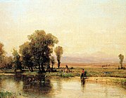
"Encampment Along The Platte" by Worthington Whittredge
The first European to discover the Platte was the French explorer Étienne de Veniard, sieur de Bourgmont in 1714, who named it the Nebraskier, an Oto word meaning "flat water". The French word for flat, plate (pronounced plat, or platte), was later applied. The river provided valuable transportation for the French trade in furs with the Pawnee and Oto Indians
The Platte lay in a gray area between Spanish and French claims in the Great Plains. Joseph Naranjo, a black explorer, had also encountered the Platte, and later guided the Villasur expedition there to stop French expansion. Theirs was the deepest penetration of Spanish exploration into the central plains.
Ceded to the United States in the Louisiana Purchase, the Platte was explored and mapped by Major Stephen H. Long in 1820. The Platte was used by American trappers, and the Great Platte River Road played an important role in westward expansion during the 19th century. It provided fresh water, game, and a clear path westward for the pioneers. Both the Oregon Trail and the Mormon Trail followed the Platte (and the North Platte). In the 1860s, the Platte and North Platte furnished the route of Pony Express and later for the Union Pacific portion of the first transcontinental railroad. In the 20th century, its valley was used for the route of the Lincoln Highway and later for Interstate 80, which parallels the Platte and the North Platte through much of Nebraska.
This is also why many of Nebraska's larger cities are located on or near the Platte River, including Omaha, Kearney, Grand Island, and North Platte. There were also historical sites along the Platte River such as Fort Kearny and other fur trading posts mostly due to the ease and abundance of traveling along the Platte River.
Then in 1859 the first irrigation ditch was built to divert water from the Platte in order to be used in farming.
Species[]
The Platte is in the middle of the Central Flyway which is a primary North- South Corridor for migratory birds which affects many species including the Whooping Crane, Piping Plover, and Interior Least Tern which are all endangered and protected under the Platte River Endangered Species Partnership as well as the Pallid Sturgeon. It is also home to many other plants and animals.
Plants that occur often in the Platte River area are Big and Little Bluestem, switch grass, and cottonwood trees. Some of the more charismatic animals are white-tail deer, many types of catfish, Canada geese, and bald eagles. The Platte River has always been able to support many animals but recently due to urbanization and farming the ecosystem is being depleted.
Management and policy[]
The criteria for overappropriation, according to the final reading of LB 962, is that if the river basin, sub basin, or reach is subject to an interstate cooperative agreement among three or more states and if, prior to such date, the department has declared a moratorium on the issuance of new surface water appropriations in such river basin, sub basin or reach and has requested each natural resource district with jurisdiction in the affected area in such river basin, sub basin or reach either to close or to continue in effect a previously adopted closure of all or part of such river basin, sub basin, or reach to the issuance of additional water well permits in accordance with subdivision. Most of the Platte River basin is currently considered as overappropriated.
Beginning in 2004, a number of Nebraska stakeholders embarked upon the Platte River Cooperative Hydrology Study (COHYST). Conducted with assistance from the United States Geological Survey and the Natural Resources Conservation Service, this study attempts to arrive at a better understanding of the geology and hydrology of the Platte River basin from the Colorado and Wyoming borders to Columbus, including the Loup basin. This improved understanding could be used to develop policies for management of the river system, both for human use and for the sake of the basin's endangered species. As of October 2009, the study is still ongoing.[1][2]
Literary reference[]
In Centennial, James A. Michener's epic novel about the West from prehistoric to modern times, the second chapter is about the geological history of the Platte River tributary. The river as stopover for sandhill cranes plays an important part in Richard Powers' 2006 novel The Echo Maker.
Algis, Laukaitis J. Searching for the Source. UNL. Lincoln: CoJMC, 2006. Caponera, Daunte. Principles of Water Law and Administration: National and International. Taylor and Francis, 1992. 126-127. Carolyn, Johnsen. Wrestling for Resources. UNL. Lincoln: CoJMC, 2006. Condra, G. E. Development of the Platte River Bottomland in South Central Nebraska. Annals of the Association of American Geographers 21 (1931): 101-105. Endangered and Threatened Species of the Platte River. Washington, DC: The National Academies P, 2005. Europeans Compete for Trade. Nebraska Studies. 20 Apr. 2008 <http://www.nebraskastudies.org/0300/frameset_reset.html?http://www.nebraskas tudies.org/0300/stories/0301_0112.htm Kirsch, Eileen. Wildlife Monographs, No. 132, Habitat Selection and Productivity of Least Terns on the Lower Platte River, Nebraska (Jan., 1996), pp. 3-48 Kirsch, Eileen et al. Colonial Waterbirds, Vol. 16, No. 2 (1993), pp. 139-148 Max, Post Van Der Burg. A Diminishing Habitat. UNL. Lincoln: CoJMC, 2006. McCammon, Sarah. Cohyst Project. UNL. Lincoln: CoJMC, 2006. Nebraska. Natural Resources. Legislative Bill 962. 2004. Nebraska State Map Collection. 29 Apr. 2008 <http://geology.com/state- map/nebraska.shtml>. Nemec, Kristine. Underground Treasure Trove. UNL. Lincoln: CoJMC, 2006. Phelps, Steven. Genetic Identity of Pallid and Shovelnose Sturgeon. Copeia, Vol. 1983, No. 3 (Aug. 16, 1983), pp. 696-700 Summary of LB 962 Activities. Nebraska Department Natural Resources, 2004.
Notes[]
- ↑ Nebraska Department of Natural Resources, "Platte River Cooperative Hydrology Study (COHYST)", retrieved October 19, 2009.
- ↑ Central Platte Natural Resources District, "Cooperative Hydrology Study (COHYST)", retrieved October 19, 2009.
Further reading[]
- Bruce, B.W. and P.B. McMahon. (1998). Shallow ground-water quality of selected land-use/aquifer settings in the South Platte River Basin, Colorado and Nebraska, 1993-95 [U.S. Geological Survey Water-resources Investigations Report 97-4229]. Denver: U.S. Department of the Interior, U.S. Geological Survey.
- Condon, S.M. (2005). Geologic studies of the Platte River, south-central Nebraska and adjacent areas, geologic maps, subsurface study, and geologic history [U.S. Geological Survey Professional Paper 1706]. Reston, VA: U.S. Department of the Interior, U.S. Geological Survey.
- Dennehy, D.F. et al. (1998). Water quality in the South Platte River Basin, Colorado, Nebraska, and Wyoming, 1992-95 [U.S. Geological Survey Circular 1167]. Washington, D.C.: U.S. Department of the Interior, U.S. Geological Survey.
- Druliner, A.D., B.J. Esmoil, and J.M. Spears. (1999). Field screening of water quality, bottom sediment, and biota associated with irrigation drainage in the North Platte Project area, Nebraska and Wyoming, 1995 [U.S. Geological Survey Water-resources Investigations Report 98-4210]. Lincoln, NE: U.S. Department of the Interior, U.S. Geological Survey.
- Hardgree, M. (1995). A selected bibliography on the hydrology of the Platte River Basin in Nebraska through 1991 [U.S. Geological Survey Open-File Report 94-496]. Lincoln, NE: U.S. Department of the Interior, U.S. Geological Survey.
- Kimbrough, R.A. and D.W. Litke. (1998). Pesticides in surface water in agricultural and urban areas of the South Platte River Basin, from Denver, Colorado, to North Platte, Nebraska, 1993-94 [U.S. Geological Survey Water-resources Investigations Report 97-4230]. Denver: U.S. Department of the Interior, U.S. Geological Survey.
- Larson, L.R. (1985). Water quality of the North Platte River, east-central Wyoming [U.S. Geological Survey Water-resources Investigations Report 84-4172]. Cheyenne, WY: U.S. Department of the Interior, U.S. Geological Survey.
- Litke, D.W. (1996). Sources and loads of nutrients in the South Platte River, Colorado and Nebraska, 1994-95 [U.S. Geological Survey Water-resources Investigations Report 96-4029]. Denver: U.S. Department of the Interior, U.S. Geological Survey.
- Sprague, L.A. and A.I. Greve. (2003). Changes in nutrient and pesticide concentrations in urban and agricultural areas of the South Platte River Basin, Colorado, Wyoming, and Nebraska, 1994-2000 [U.S. Geological Survey Water-resources Investigations Report 02-4270]. Denver: U.S. Department of the Interior, U.S. Geological Survey.
See also[]
| Wikisource has the text of the 1911 Encyclopædia Britannica article Platte. |
- List of Nebraska rivers
cs:Platte et:Platte eo:Plato (rivero) sw:Mto Platte la:Platte Flumen lt:Pleitas ja:プラット川 no:Platte (elv) pt:Rio Platte ru:Платт (река) simple:Platte River sv:Platte River